Inks Lake and Inks Lake State Park


Inks Lake and Inks Lake State Park
|
|
| Home | Lessons | Rentals | How To | Forums | Videos | Texas Regattas | Bookstore | Search | Sailboats for sale |
| Sailboat Photo Gallery |
Sails |
Scam Warnings | Texas Lakes | Advertise with us | Contact | Free Sailboat Ad |
|
We always enjoy visiting Inks Lake State Park. With 1201 acres and over 7 miles of hiking trails it's much more than just access to Inks Lake. Many fine campsites, about 200, give you a choice of camping near the water or a short walk away. Mini cabins and primitive camping are also available. On our Dec. 12, 2006 trip to Inks Lake we took the Flying Scot and sailed completely around the 803 acre lake. Waterfowl abound, we saw blue herons, comorants, ducks, pelicans, and even an Egyptian Goose! Whitetail deer wander through the park all the time. Inks Lake is a good place to sail, the Inks Lake State Park has the only public boat ramp, but it is a good double ramp with good docks. The hills around the lake moderate the wind somewhat, but we had plenty of wind. January, 2008: While Inks Lake State park has free wifi, they had only three antennaes. If you are "in the parking lot" of the entrance, the park store, or restroom #6 you can use the internet. It was faster than dialup, but not very fast. We were unable to use Outlook to check our email for some reason. We could not connect to the internet in any campsite.
Map of Inks Lake
This is a sailing tour of Inks Lake, starting at the boat ramp at Inks Lake State Park and sailing counter clockwise around the lake. I've divided the lake into four sections as we went around the lake. Click on the area you'd like to visit first:
1. From the boat ramp to the Devils Waterhole.
2. From the Devils Waterhole to the Hwy 29 Bridge.
3. The west shore, across the lake from the state park, Camp Longhorn to the dam.
4. The southeastern shore of the state park.
|
Inks Lake State Park headquarters Directions to Inks Lake State Park: Keep in mind that you want to be near the Colorado river, on the east side, and follow the river to Inks Lake. If you are north of Inks Lake From Burnet on 29 west, watch for the brown State Park sign and Park Road 4, less than 10 miles. Turn left on Park Road 4 and it's just a few miles to the park. If you come to the above mentioned bridge you missed it. If you are south of Inks Lake: From Marble Falls, go north on 281 a few miles and turn left on Park Road 4. Go past Longhorn Caverns, and a few miles after you pass 2342 you will come to the park. From Kingsland: Go east on 1431, after crossing the bridge stay in the left hand lane and turn left on 2342. You will come to a stop sign at Park Road 4, continue straight ahead onto Park Road 4 and in a few miles you are at the park.
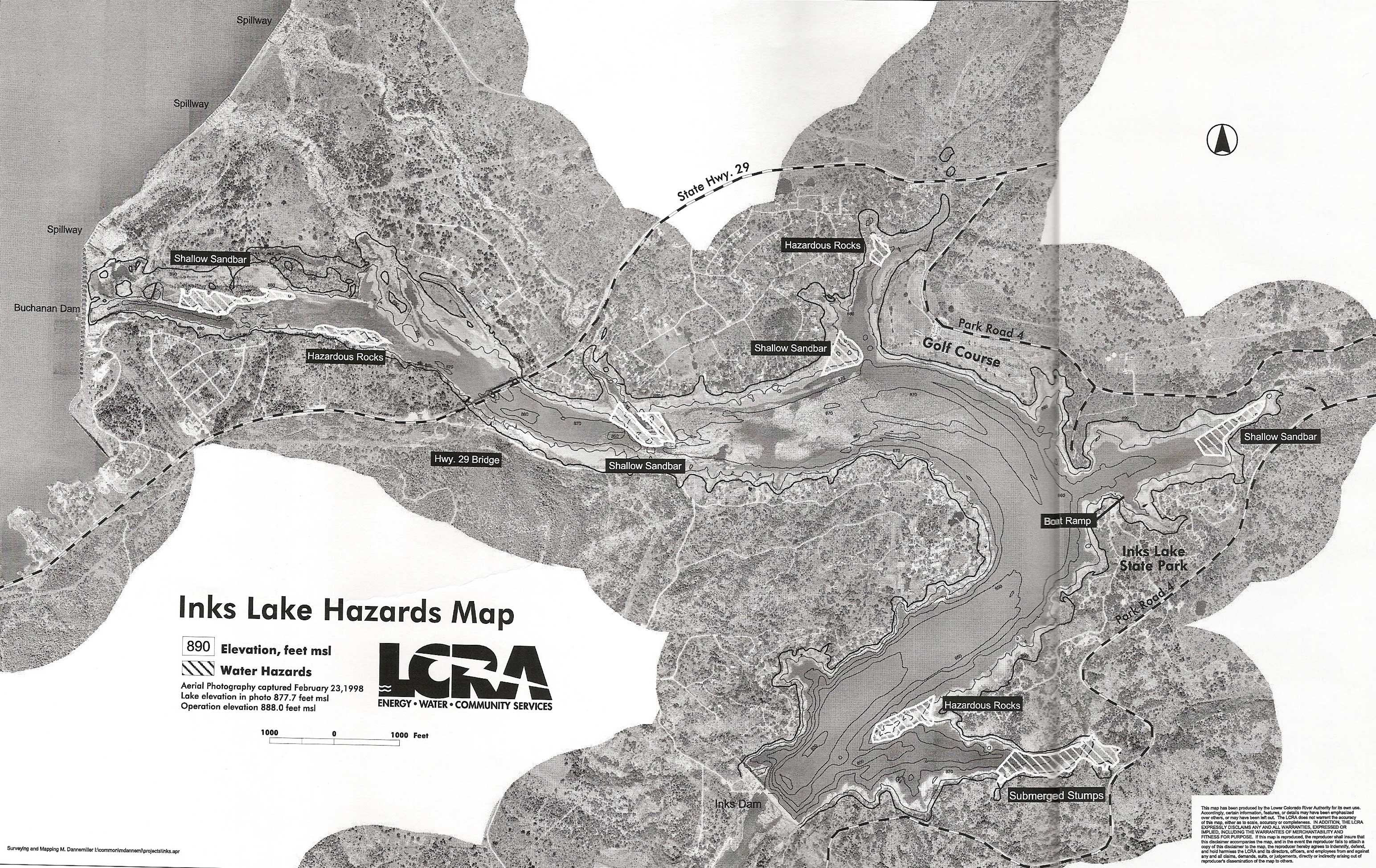
We ran aground several times on our sail. If we had had this map showing some of the hazards we would have faired better, but the hazards are not all marked! Click picture for larger image. |